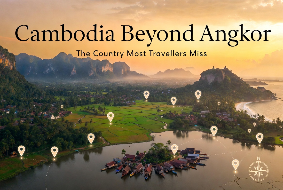
Cambodia Beyond Angkor: The Country Most Travellers Miss
There is an hour in Cambodia — somewhere between five and six in the afternoon, when the day's heat has stopped pressing down and the sun has started to angle rather than burn — that makes the country look like the painting it actually is. The laterite turns the colour of old terracotta. The lime-washed plaster of the colonial shophouses softens to bone. The rice goes from sodium-bright green to a green that has remembered it is a plant. This is the hour the country gives away its character, and most travellers miss it because they are queuing for sunset at Phnom Bakheng with eleven hundred other people who have read the same guidebook.
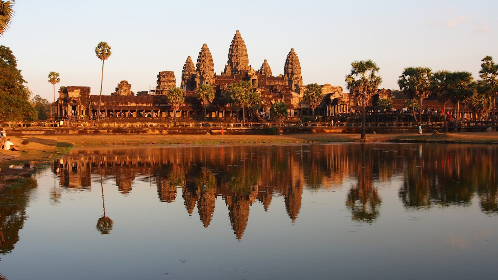
Angkor deserves what's said about it. The Bayon's faces really are uncanny at 6:40 am in February; Ta Prohm's strangler figs really do hold the stones up rather than press them down. But Angkor was the capital of an empire that ran from southern Laos to the Gulf of Thailand for six hundred years, and what an empire leaves behind doesn't stop at the moat of one temple complex. The country beyond the Siem Reap perimeter is the country the Khmer themselves still live in: a place of pepper terraces and pre-Angkorian brick, of pine-forested uplands and bioluminescent shallows, of a colonial-era provincial capital with eight hundred shophouses still standing on the eastern bank of a single brown river. The reader who has already done Bangkok and Hoi An and the obligatory three days in Siem Reap arrives at the obvious question — is there more? — and the answer is yes, considerably more, and almost none of it is crowded.
This is a piece for the second visit. Or for the first visit if you arrive willing to drive a little further than the Angkor gate.
The premise — why everyone goes to Angkor and stops
The geography of Cambodian tourism is a function of two airports and one river. Siem Reap and Phnom Penh hold ninety percent of the country's foreign arrivals; the road between them and the Mekong corridor that links them carries the rest. Everything else — the south coast, the eastern highlands, the north and northwest near the Thai border — exists, on most itineraries, as a paragraph or a footnote. There is a practical reason for this. Cambodia is small enough that you feel you should be able to see it in a week, and most package tours sell you that week as Angkor-plus-capital. There is also an inherited reason: the country was effectively closed to mainstream tourism until the mid-1990s, and the infrastructure that bypasses the two hubs is still catching up.
The country beyond Angkor is the country the Khmer themselves still live in, and almost none of it is crowded.
What this means in practice is that a traveller willing to add four or five days to a standard itinerary can see things — entire UNESCO sites, working colonial towns, indigenous-managed forests — at almost gallery-quiet attendance. I have walked Banteay Chhmar at four in the afternoon and counted three other people, two of them local. I have driven through Sambor Prei Kuk's outer enclosure at noon in March and seen no one but the gatekeeper. If you came to Southeast Asia partly to escape the photographable life of the European city, the off-Angkor Cambodia is one of the last corners of the region where that escape is still cheap and uncomplicated. (For the practical question of whether to come at all — visas, security, the state of the riel — see our standing piece, Can I travel to Cambodia right now?, which we update on a rolling basis.)
The pieces that follow are arranged the way I'd shoot them, roughly clockwise from northwest to northeast and back through the south, with a routing at the end that knits them into a ten-day trip.
Battambang — the colonial city the guidebooks under-rate
You arrive in Battambang the way you arrive in any river city: by following the brown line on the map. The Sangker is not a beautiful river in the conventional sense — it is the colour of weak tea, with water hyacinth pulled along like green lace — but the eastern bank holds what is, by quiet consensus among architecture writers, the densest surviving collection of French colonial shophouses in mainland Southeast Asia. Eight hundred buildings, give or take, in a protected heritage zone the size of about ten city blocks. The provincial governor's house, completed in 1907, sits at the southern end in cream and ochre stucco. The Phsar Nath market, an Art Deco rotunda from the late 1930s, anchors the centre. In between: row after row of two-storey shophouses with cast-iron balconies, persiennes in the green and pale-blue palette the French left behind, and ground-floor tiles in geometric Marseille-cement patterns that are still being lifted out of buildings and sold to Bangkok restorers when nobody is paying attention.
The right hour for these streets is five-thirty in the afternoon, when the sun comes in almost level across the river and lights the shutters and stucco sideways. The same buildings at noon look bleached and unremarkable; in the soft, raking 5:30 pm light they declare what they are. Walk Street 2½ and Street 1, then cut inland to the smaller streets behind the market and look up — half the second storeys carry signage in three scripts (Khmer, Chinese, French) layered over each other in fading paint.
Battambang also runs the country's best small art scene. Phare Ponleu Selpak, founded in 1994 as an arts and circus school for children from refugee backgrounds, has graduated two generations of painters, illustrators, and graphic novelists; their gallery and the studios around Romcheik 5 on the river's west bank are open to walk-ins. The bamboo railway — the norry — still runs, although what runs is now the rebuilt tourist version east of the city between O Dambong and O Sra Lav, not the colonial-era track that was retired during the Northern Line restoration. It is a five-dollar, twenty-minute ride on a bamboo platform over old tank-axle bogies, and it is, frankly, more charming for being slightly silly than for being authentic. Take it. Then go look at the buildings.
Walk Street 2½ at five-thirty in the afternoon: half the second storeys carry signage in three scripts layered over each other in fading paint.
Kep and Kampot — pepper, salt, and the slow return of the jungle
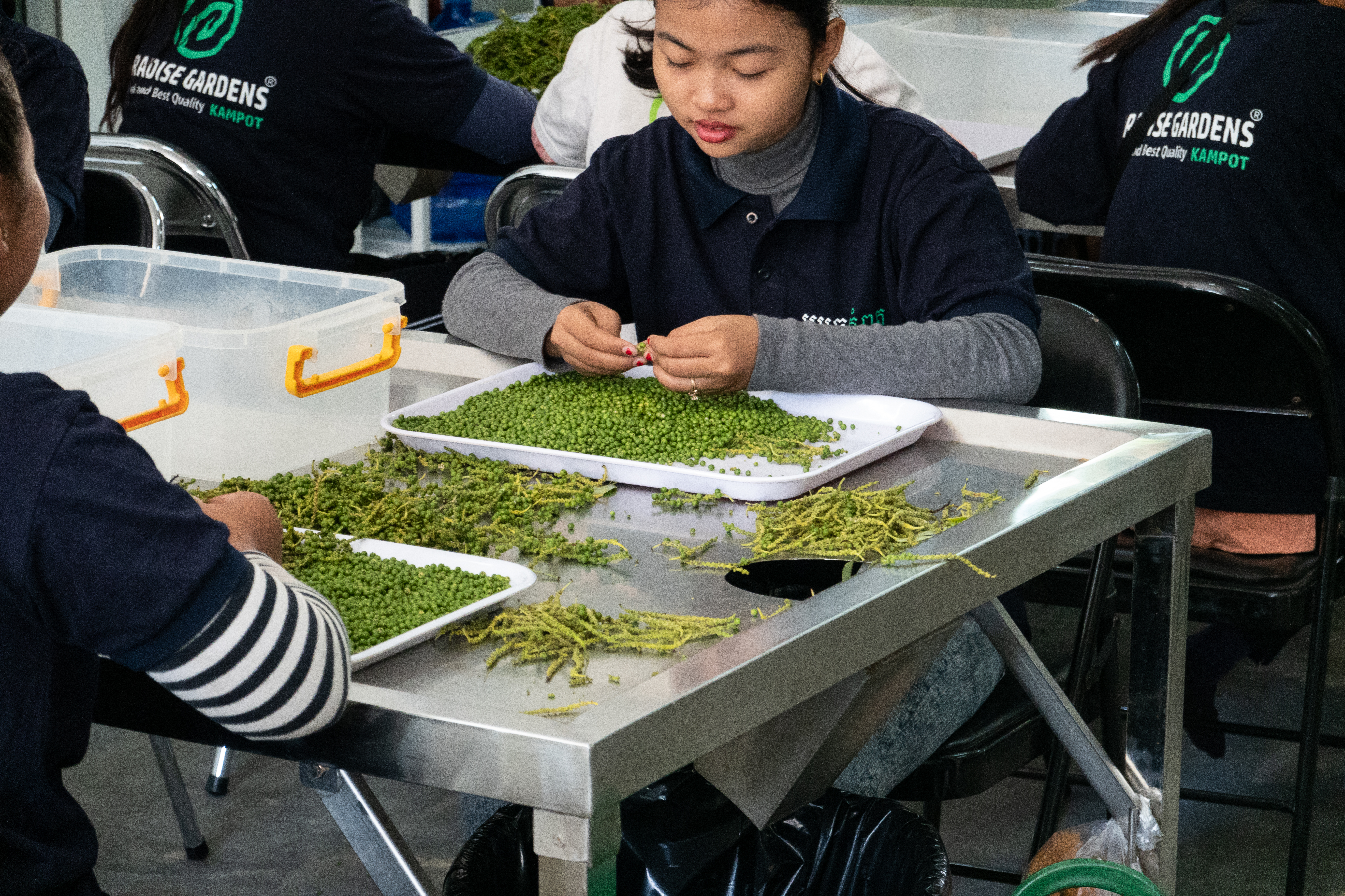
The road from Phnom Penh down to the Kampot coast passes through the kind of flat farmland that does not announce itself, and then suddenly you are on Bokor's lower slope and the climate has changed. The air smells of sea and lemongrass. Kampot town itself is a single drowsy curve of riverfront — more decayed shophouses, this time with the mountain behind them rather than another street — and the country's pepper terraces begin maybe twenty minutes inland, in the red-earth foothills where Kampot pepper has been grown commercially since the French organised the trade in the 1870s.
A pepper plantation at four in the afternoon is a strange and beautiful thing to photograph. The vines grow on wooden posts ten or twelve feet high, set in long parallel rows; from the end of a row, in the last hour of light, you get a corridor of green going to a vanishing point with the sun raking through it. The vines themselves are dark, leathery, lower-key than the foliage around them, and the red volcanic soil — the same mineral terroir that the Parisien restaurants of the 1930s used to specify by farm — is the colour of old brick. La Plantation, Sothy's, Starling Farm: the three best-known are all visit-friendly, all PGI-certified, all happy to walk you through the harvest cycle and the difference between green, black, red, and white pepper picked from the same vine at different ripeness.
Twenty-five kilometres further along the coast, Kep is what Kampot is going to be in fifteen years if it isn't careful. A small French resort town from the 1910s and 1920s, scattered with the bones of art-deco and modernist seaside villas that were comprehensively ruined in the 1970s and have been, since the early 2000s, slowly disappearing back under the jungle. Some have been bought and restored — Knai Bang Chatt, the famous one, is a 1960s villa attributed to the Cambodian modernist Lu Ban Hap. Most have not. The pleasure of Kep is walking the back roads with a long lens and a slow attention, finding the geometry of a teak-shuttered window behind a curtain of vine, or the chalk-white rectangle of a former dining room half-eaten by banyan roots.
The Kep salt flats sit just inland from the crab market — about 4,500 hectares of shallow evaporation pans that produce the country's fleur de sel. Go at midday, despite the heat: the white pans and pale wooden rake-handles photograph as graphic abstraction in flat overhead light, the kind of frame that needs the sun straight up to work.
Koh Rong Sanloem — the alternative to overdevelopment
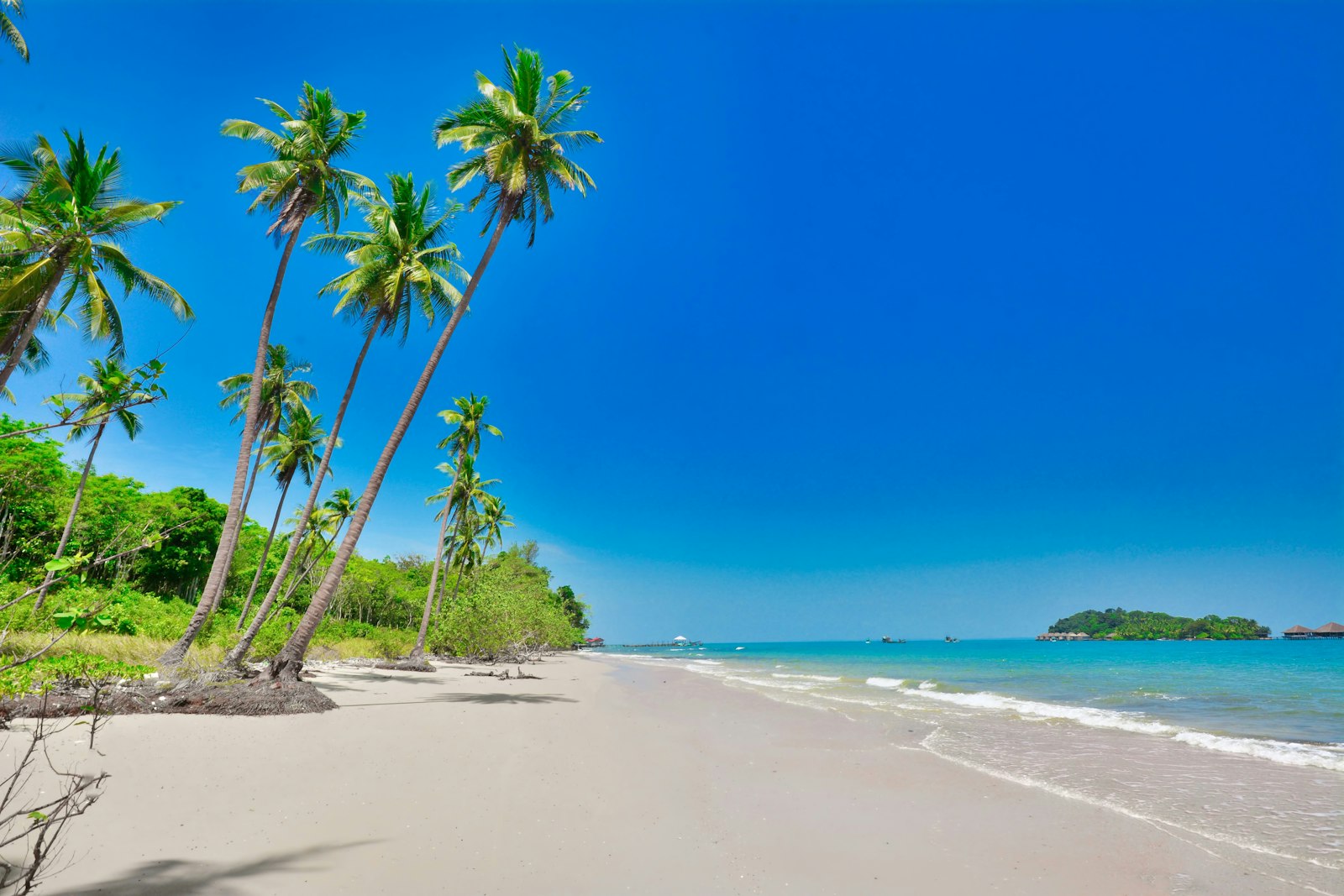
Koh Rong, the bigger island, has gone the way of full-moon parties and Russian construction money. Its smaller sister, Koh Rong Sanloem — half an hour by speedboat from Sihanoukville, half an hour again from Koh Rong — has so far kept itself to a slower register: small bungalow operations under the casuarinas, no road on the island, the lights cut at ten on most beaches. There are three landings, each with a different beach: Saracen Bay on the east side, which is the main pier and the broadest sweep of sand; M'Pai Bay (also called 23 Village) at the north end, the budget-traveller end; and Sunset Beach on the west, which is what its name says it is.
Sunset Beach is the one I would photograph. It is reached by a thirty-minute jungle path across the island's narrow waist, and once you arrive you understand the geometry: a low arc of white sand facing due west into the Gulf of Thailand, palms leaning over it at the slight tilt that storm-coast palms have, and almost nothing built behind the sand except a handful of bungalows and a single restaurant. At blue hour — that ten-minute window after the sun has dropped but before the sky has gone — the water turns a green-tinted teal that is, almost exactly, the colour of oxidised copper. There are no street lights on the beach. On nights without a moon, the water glows.
The bioluminescence here is dinoflagellate plankton — the same species that lights up bays from Puerto Rico to the Maldives — and it is best seen on Sunset Beach precisely because there is so little artificial light. Wade in to chest height after eleven, stop moving, then sweep an arm through the water. The light follows your hand. (Ferry schedules to Koh Rong Sanloem reshuffled after the 2024 storm season and ferry companies — Speed Ferry Cambodia, Buva Sea, Island Speed Ferry — still occasionally swap piers in Sihanoukville depending on conditions. Always reconfirm the day before.)
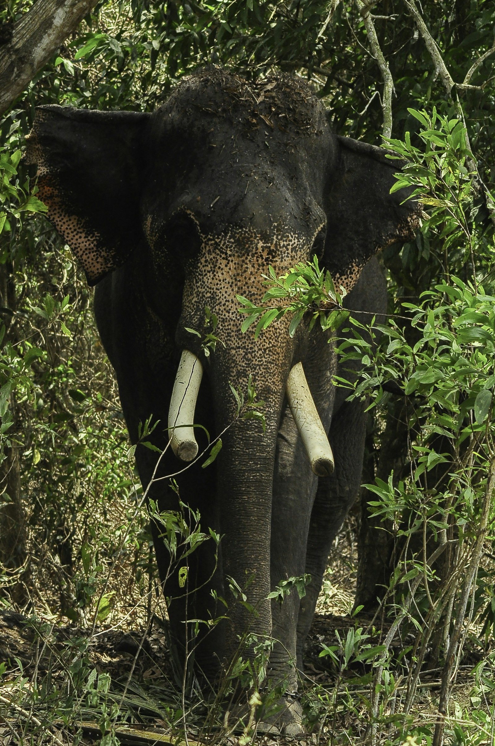
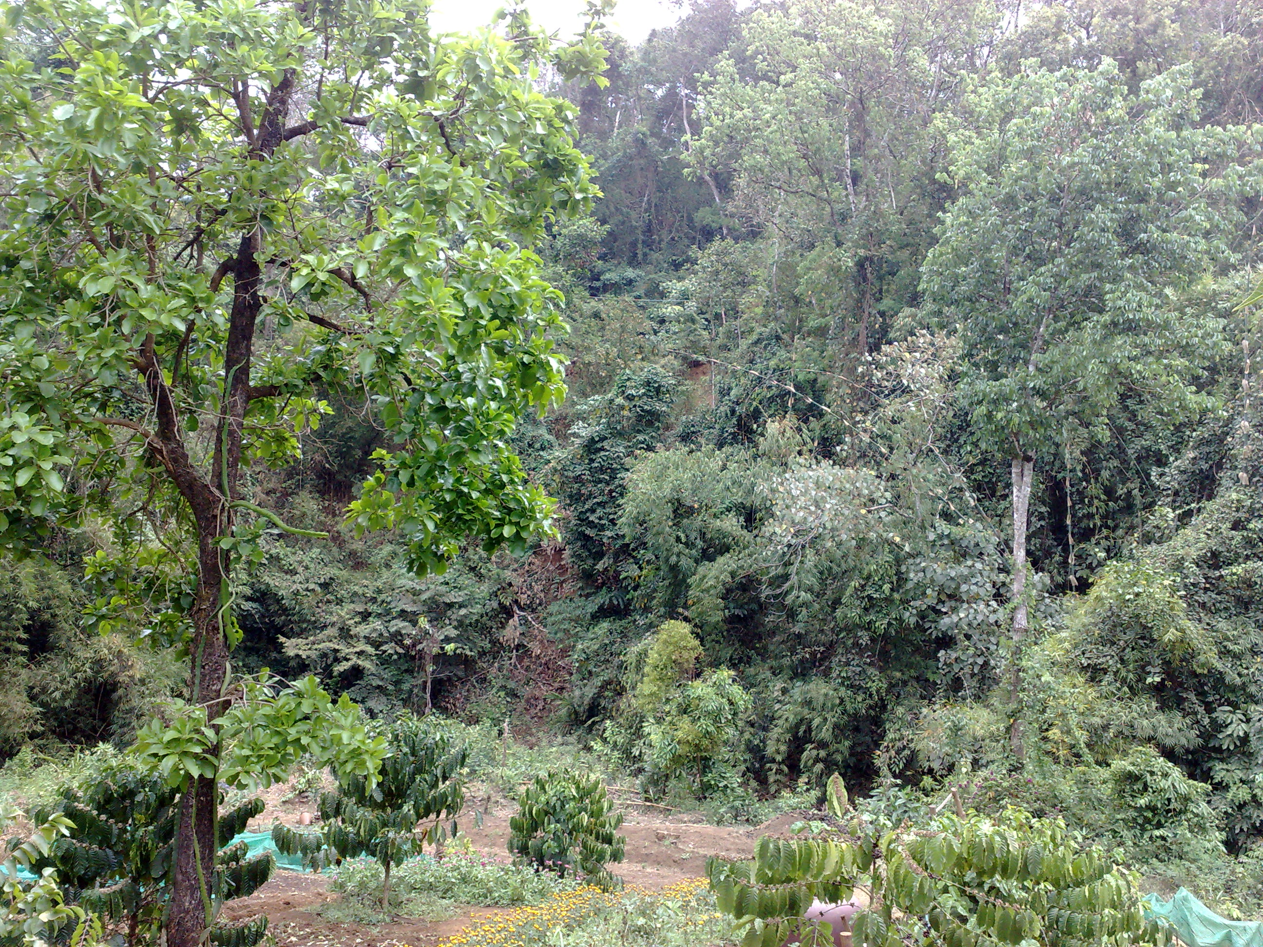
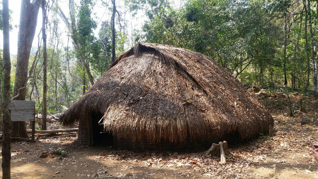
Mondulkiri — pine forest, Bunong villages, elephants who are not for riding
You climb to Mondulkiri. The road from Snuol turns east and starts winding up onto the basalt plateau, and within an hour you have left the dry-rice country for a higher, cooler landscape of pine and dipterocarp forest that looks, improbably, like northern Laos or even the foothills of the Annamites. This is Cambodia's eastern highlands — average elevation about 800 metres, average temperature five to seven degrees below the lowlands, fog in the early mornings, evenings cool enough to want a long-sleeved shirt.
Sen Monorom is the small provincial capital and the staging point. From there you reach the Bunong villages — the Bunong are one of Cambodia's indigenous Mon-Khmer peoples, the largest population in the eastern uplands — and the elephant sanctuaries that have, in the last fifteen years, replaced the older ride-and-show camps. Two operations meet the current ethical standard: the Elephant Valley Project (EVP), run by the registered NGO Elephant Livelihood Initiative Environment and recipient of the 2025 Asian Ecotourism Network award for innovative ecotourism, and the Mondulkiri Project, a Cambodian-owned and Cambodian-staffed sanctuary that has held an agreement with Bunong elders since 2013 to protect a large tract of forest near Sen Monorom. Both forbid riding. Both forbid bathing-with-elephants tourism. Both let the elephants do what elephants in forest do — which is to walk slowly, eat for fourteen hours a day, and not perform.
An elephant in dipterocarp forest at ten in the morning, when the canopy mist hasn't quite burned off, photographs differently than an elephant anywhere else.
What you photograph in Mondulkiri is the forest itself as much as the animals. The Bou Sra waterfall north of Sen Monorom is two-tiered and properly thunderous in the second half of the rainy season; the pine ridges south of town give you something that looks, at golden hour, more like the Sierra foothills than mainland Southeast Asia. Stay two nights. The drive is long.
Banteay Chhmar — the temple complex with no crowds
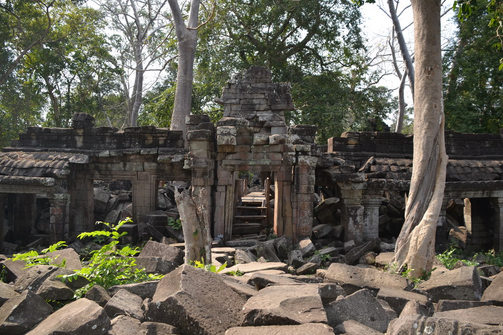
Three and a half hours northwest of Siem Reap, almost at the Thai border, sits the largest Angkorian temple complex in the country that almost nobody has heard of. Banteay Chhmar was built in the late 1100s by Jayavarman VII — the same Bayon-faces, smiling-tower king — as a memorial to his son, who died in battle. It is enormous: a moated central enclosure roughly the size of Banteay Kdei, ringed by satellite shrines and reservoirs that extend the footprint to nearly two hundred hectares. Almost a kilometre of carved laterite reliefs survive on the inner enclosure walls, including the famous multi-armed Avalokiteshvara panel that the Global Heritage Fund and the World Monuments Fund have spent the last two decades stabilising.
It is in laterite, not the sandstone of Angkor Wat, and laterite weathers differently — softer, more sponge-like in texture, the colour of a saturated brick after rain. In the last hour of afternoon, with the sun coming sideways through the doorways and lighting the relief panels from across the courtyard, the stone holds the orange of an old terracotta tile. There are no tour buses. There is no admission gate in the Angkor sense; you pay a community fee at the village office, and the village runs the homestays.
The Banteay Chhmar Community-Based Tourism programme, set up with the Global Heritage Fund in the early 2010s, places visitors in six traditional Khmer wooden houses around the village. You sleep upstairs on a thin mattress under a mosquito net, eat what the family eats — usually a simple amok or grilled river fish with rice — and pay a fixed rate that goes directly to the household and to the temple-conservation fund. It is, simply, the most direct route into temple Cambodia I know of. Walk the central enclosure at five in the afternoon, sleep in the village, walk it again at six the next morning when the laterite still holds the night's cool, and you will have spent twelve hours at one of Jayavarman VII's most ambitious projects with possibly six other foreign visitors in your peripheral vision.
Sambor Prei Kuk — pre-Angkorian brick in the forest
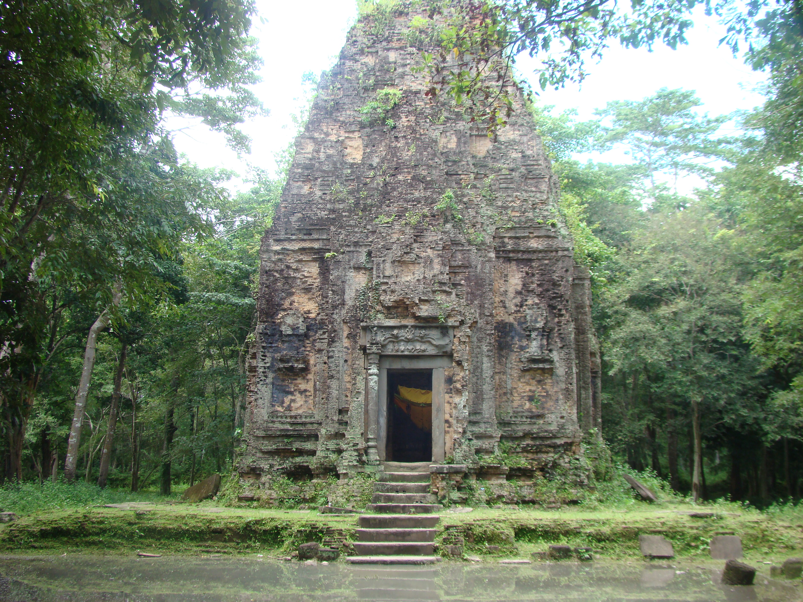
Two hours northeast of Kampong Thom — itself a couple of hours northeast of Phnom Penh on the road up to Siem Reap — Sambor Prei Kuk is older than Angkor by about three hundred years. The capital of the Chenla kingdom under King Ishanavarman I in the early seventh century, it predates Angkor Wat by half a millennium, and its architectural vocabulary — slim brick towers on square or octagonal plans, sandstone lintels carved with foliate medallions, no central mountain-temple — is what the later Angkorian style grew out of, slowly and via several intermediate kingdoms, over the next four hundred years. UNESCO inscribed it on the World Heritage list on 8 July 2017. Visitor numbers have not yet caught up.
What you walk through, at Sambor Prei Kuk, is forest. The temples — more than a hundred of them, in three named groups: Prasat Sambor, Prasat Yeai Poeun, Prasat Tao — are scattered across about thirty square kilometres of low-canopy dipterocarp and bamboo, and almost every brick tower is wrapped in or supported by a strangler fig. The site does the trick that Ta Prohm became famous for, except quieter, smaller-scale, in brick instead of sandstone, and without the rope barriers. Ten of the towers are octagonal — the only octagonal temple plan in Southeast Asian architectural history, and a small mystery of Chenla design that scholars still argue about politely.
Light, here, is filtered rather than raking. The canopy is high enough to throw soft green shade across the brickwork for most of the day, and the best window is between ten in the morning and noon, when the sun is high enough to drop dappled light onto the towers without the contrast going harsh. The site is reachable as a long day trip from Siem Reap (three hours each way) but is better seen on a slow drive between Phnom Penh and Siem Reap with a night in Kampong Thom.
A ten-day routing
This is the trip I'd build for the reader who has done a standard Cambodia week before, or who has done Thailand and Vietnam already and wants Cambodia to be the slow leg. It assumes arrival into Siem Reap and departure from Phnom Penh, but reverses cleanly.
Day 1. Arrive Siem Reap. Settle in. Eat early. (Where to stay in Siem Reap — a working architect's notes covers the lodging side.)
Day 2. Angkor — but only one temple. Banteay Srei at first light if you've never seen it, Ta Prohm if you have. Afternoon off.
Day 3. Drive to Banteay Chhmar (3.5 hours northwest). Walk the central enclosure at 4 pm. CBT homestay.
Day 4. Banteay Chhmar at 6 am. Drive back via Sisophon to Battambang (about 3 hours). Arrive late afternoon for the east-bank shophouse walk.
Day 5. Battambang. Phare Ponleu Selpak in the morning, norry at noon, Romcheik 5 galleries in the afternoon, river-bank walk at golden hour.
Day 6. Long drive day: Battambang → Kampong Thom (about 5 hours). Afternoon at Sambor Prei Kuk; sleep in Kampong Thom.
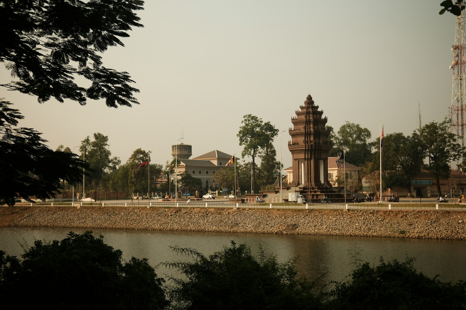
Day 7. Drive Kampong Thom → Phnom Penh (3 hours). Half-day in the capital — Tuol Sleng and the Royal Palace, but only if you have not been before.
Day 8. Phnom Penh → Kampot (3 hours). Afternoon at a pepper plantation in the back hills.
Day 9. Kampot. Morning at the Kep salt flats and crab market; afternoon in the back-road villas of Kep; sunset on the Kampot riverfront.
Day 10. Optional Koh Rong Sanloem extension (three-hour drive + 30-minute ferry from Sihanoukville to Saracen Bay, then walk across the island to Sunset Beach). Or fly out of Phnom Penh.
For the question of when — the months that hold the light this piece is written around — see The Cambodia–Vietnam light calendar for the full month-by-month breakdown. Briefly: November through February is the window. The air clears, the rains stop, and the country looks like itself again.
What the photograph is really of
I keep returning to one frame from Banteay Chhmar — late afternoon, the laterite the colour of a tile fired sixty years ago, a green wall of bush behind, no one in the courtyard but a single villager walking back from the rice. It is not a frame Angkor can give you. Angkor is, in its way, finished — held in place by UNESCO and the apsara guards and the four hundred coaches that arrive at six in the morning. The rest of Cambodia is unfinished. The shophouses in Battambang are still being lived in. The pepper farmers in Kampot are still selecting cuttings. The Bunong are still managing the forest. Sambor Prei Kuk is still a working forest as well as a working temple zone. There is something about the country, in these quieter rooms, that feels less like a place you are looking at and more like a place you are slightly intruding upon. Which is, I think, the correct register for any decent photograph of anywhere.
Come for Angkor. Stay for what comes after.
Italian travel photographer-writer. Architecture, landscape, the light. Slow, deliberate, image-led essays.
✦ More from Marco Rossi


✦ Keep reading
More from this region

More in Destinations
✦ Discussion
Start the discussion
No replies yet — yours could be the first.